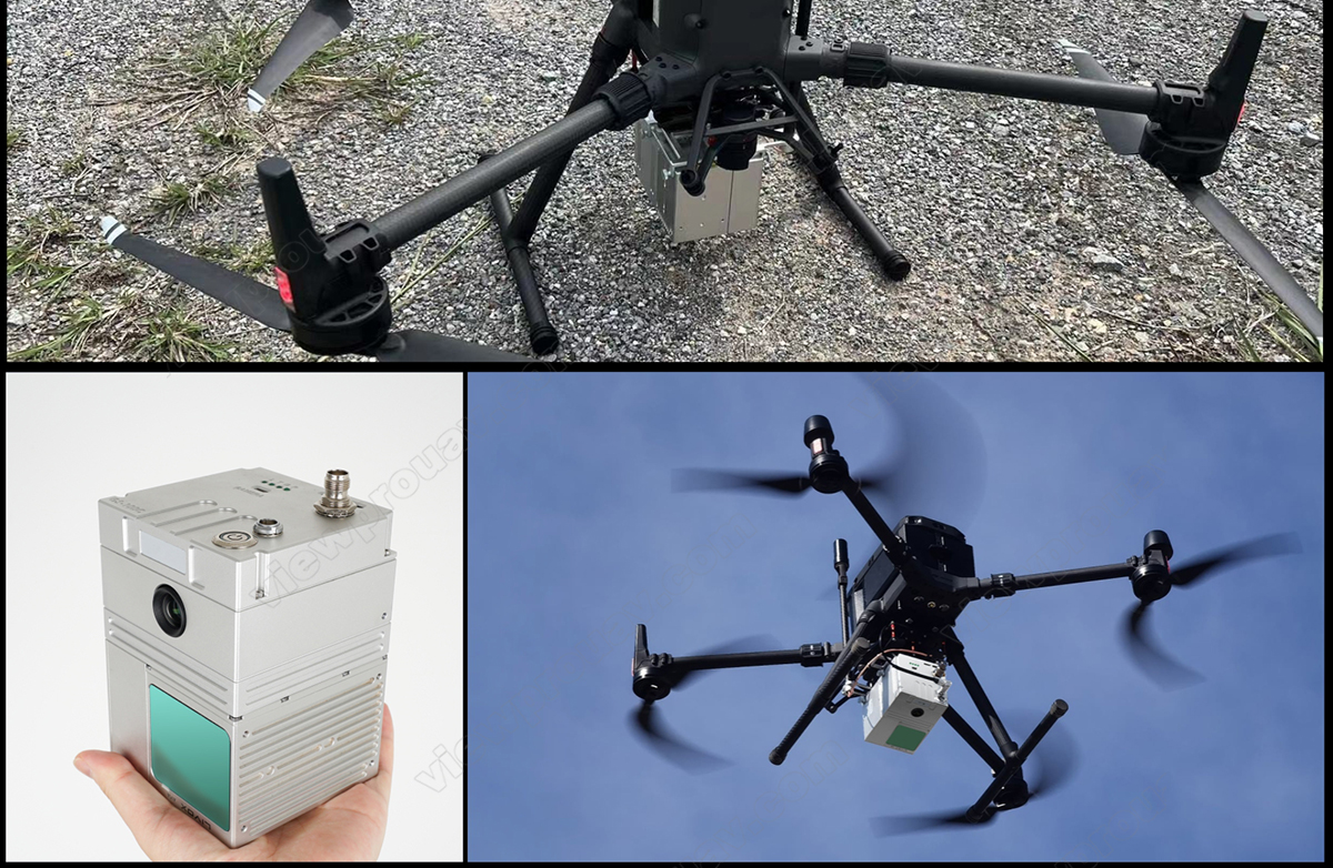
GS-100C UAV Laser Lidar Scanning System with 24MP Camera for Drone 3D Mapping and Surveying
GS-100C LiDAR scanning system integrates with Livox new generation laser scanner, GNSS satellite precise position system, INS (inertial navigation system) and Sony A6000 24mp camera which is a compact LIDAR point cloud data acquisition system to enable real-time,dynamic and massive collection of high-precision point cloud data and image information.
Description
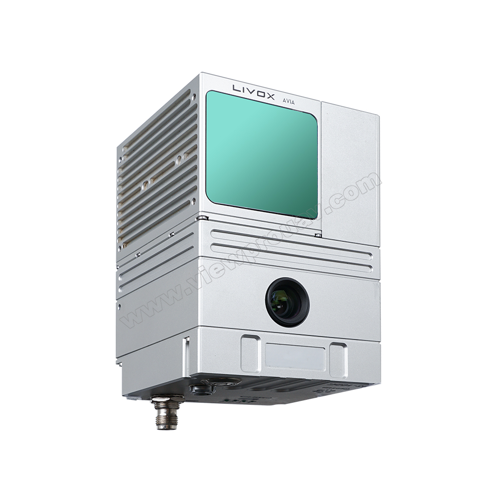
GS-100C UAV LiDAR System
High Precision GNSS, IMU INS & 24MP Surveying Camera
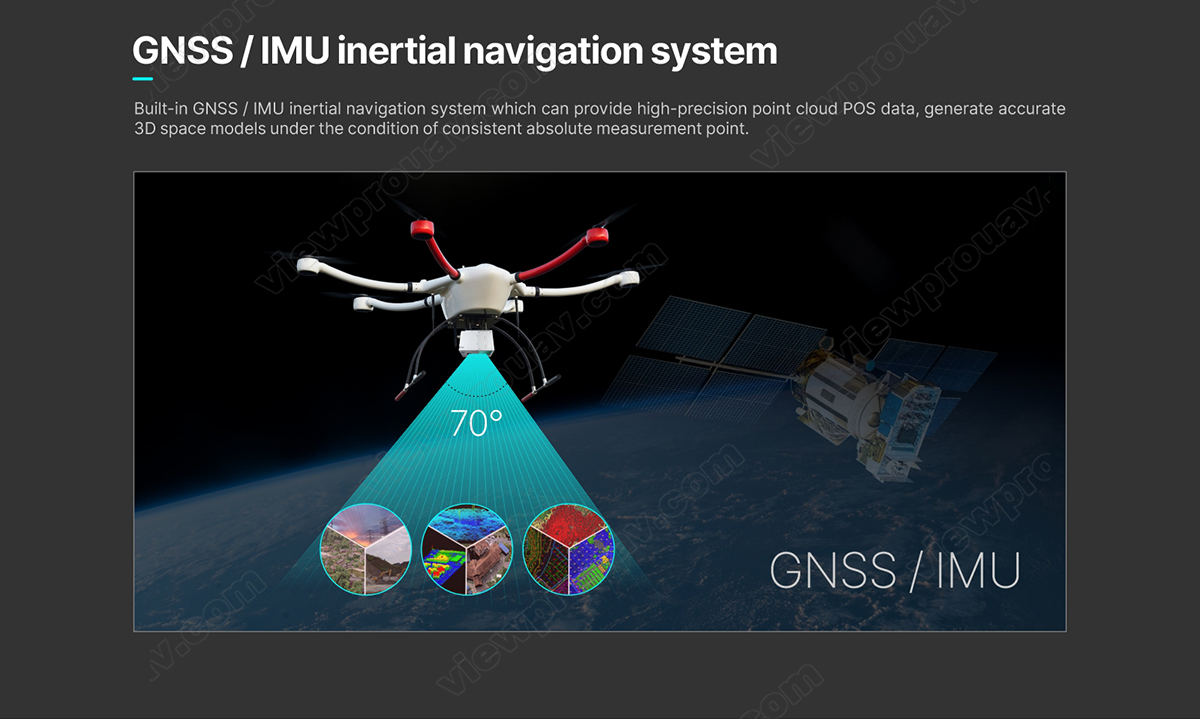
The feature of **high precision GNSS position** and **IMU INS** ensure GS-100C active and real-time perception of the environment, dynamic spatial position relationship of objects and also generate accurate **3D space models** under the condition of consistent absolute measurement point.
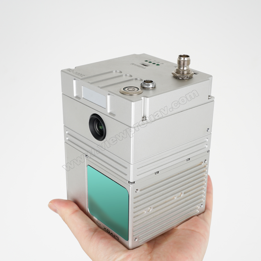
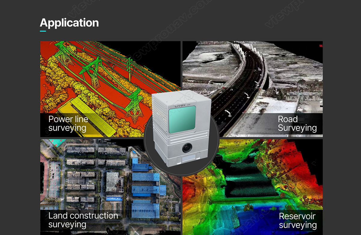
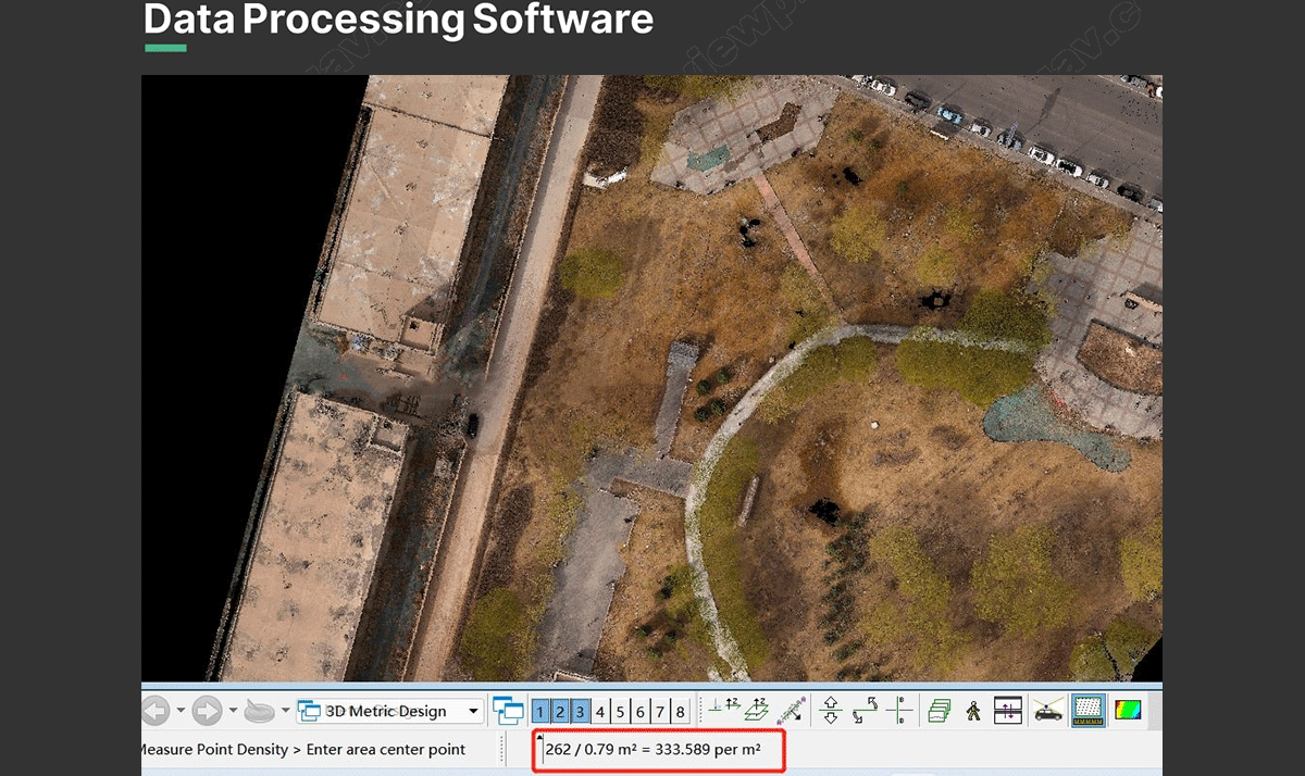
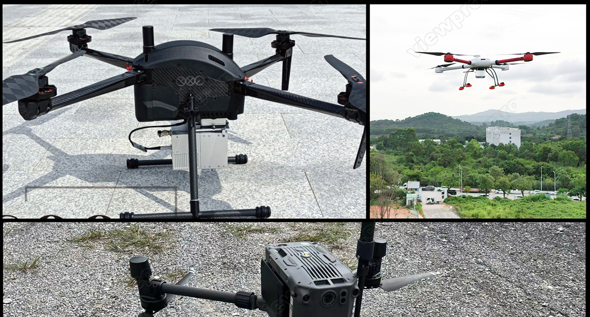
Features with light-weight (only **1.05kg**), fast data processing speed, it can be integrated with various multicopter to quick obtain the 3D position and attribute information of the object in the mission area. Through the data processing software, it will generate the digital image such as **DEM, DOM (Sony A6000 24MP surveying camera), DSM, DRG, DLG**. Which can be widely used in the **Digital city construction**, **river and soil research**, **Land survey**, **Forestry and Agriculture analysis**.
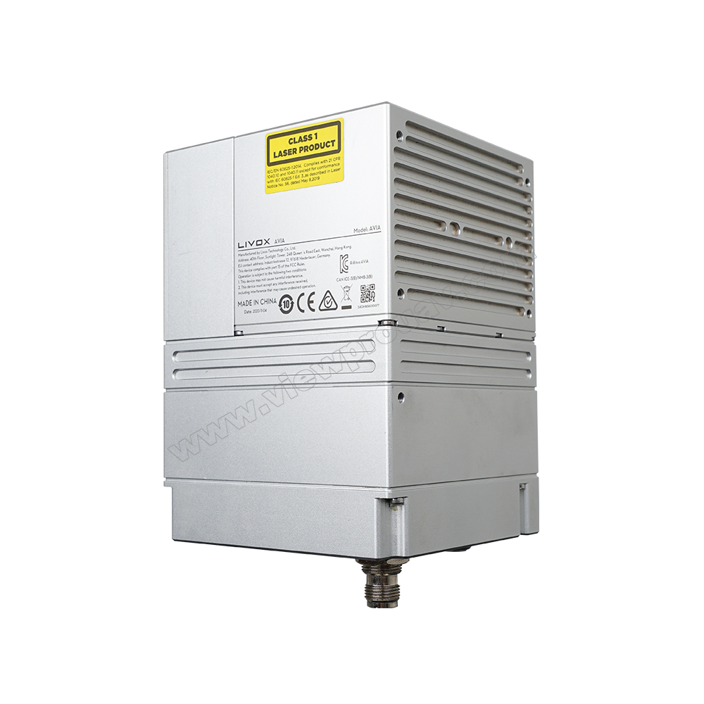
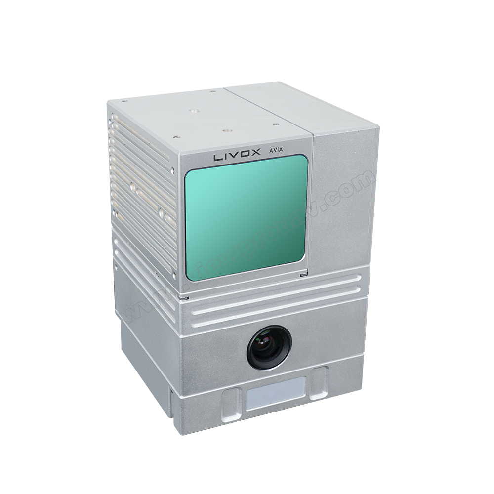
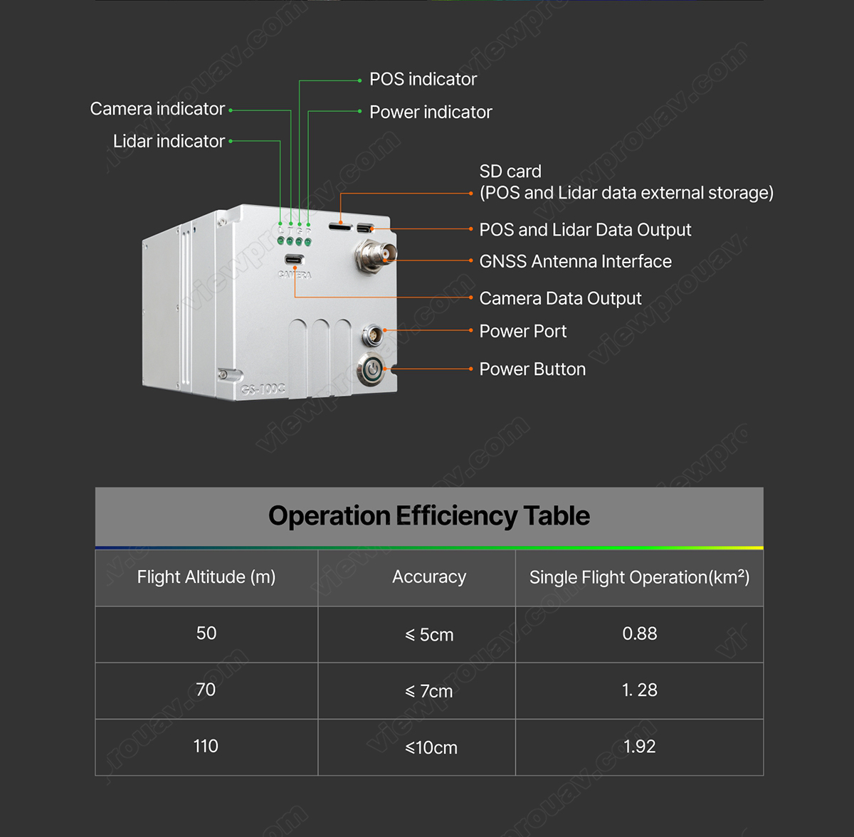
Product Images and Diagrams
Specification
| Model: GS-100C | Item | Parameter | ||
|---|---|---|---|---|
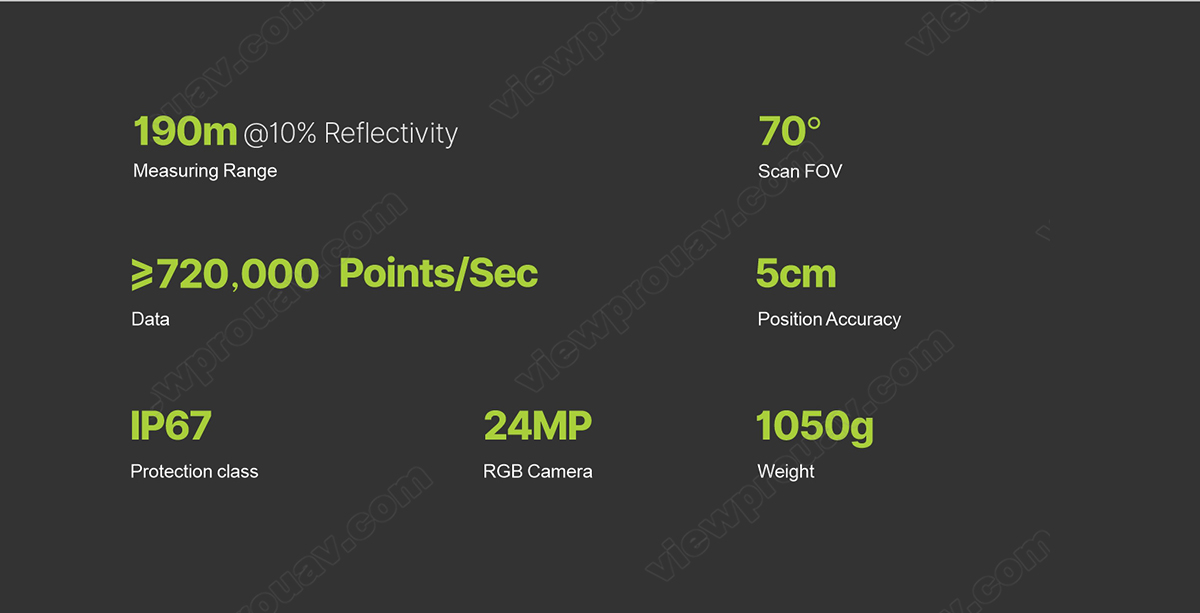
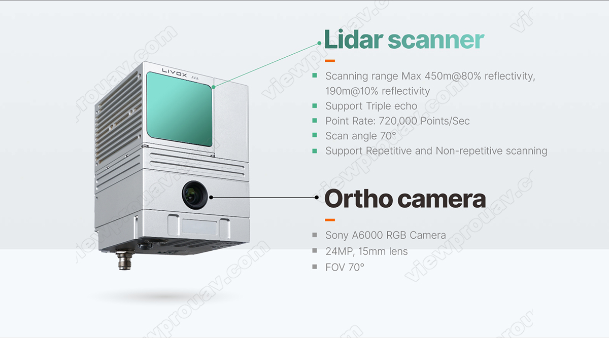
| Laser Scanner | Measuring Range | 190m@10% reflectivity | ||
| Laser Class | 905nm Class1 (IEC 60825-1:2014) | |||
| Laser Line Number | Equivalent to 64-beam | |||
| FOV | 70° the circular view | |||
| Range Accuracy (1σ @ 20m) | 2 cm | |||
| Data | Triple echo, **720,000 Points/Sec** | |||
| Camera | FOV | 70° | ||
| Resolution | **24MP** | |||
| Focus length (mm) | 15mm | |||
| POS | Update Frequency | 200HZ | ||
| Pitch /Roll Accuracy | **0.015°** | |||
| Heading Accuracy | **0.040°** | |||
| Position Accuracy | ≤0.05m | |||
| GNSS Signal Type | GPS L1/L2/L5, GLONASS L1/L2, BDS B1/B2/B3, GAL E1/E5a/E5b | |||
| System Parameter | Accuracy | **≤10cm@110m** | ||
| Weight | **1050g** | |||
| Working Temperature | -20°~+55° | |||
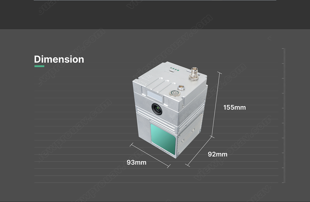
| Dimension | 15.5*9.2*9.3cm | |||
| Storage | Internal 64 GB, Max support 128GB TF card | |||
| Carrying Platform | Multicopter with 10m/s flight speed | |||
Operation Efficiency Table
| Flight Altitude (m) | Accuracy | Single Flight Operation(km²) |
|---|---|---|
| 50 | ≤5cm | 0.88 |
| 70 | ≤7cm | 1.28 |
| 110 | ≤10cm | 1.92 |