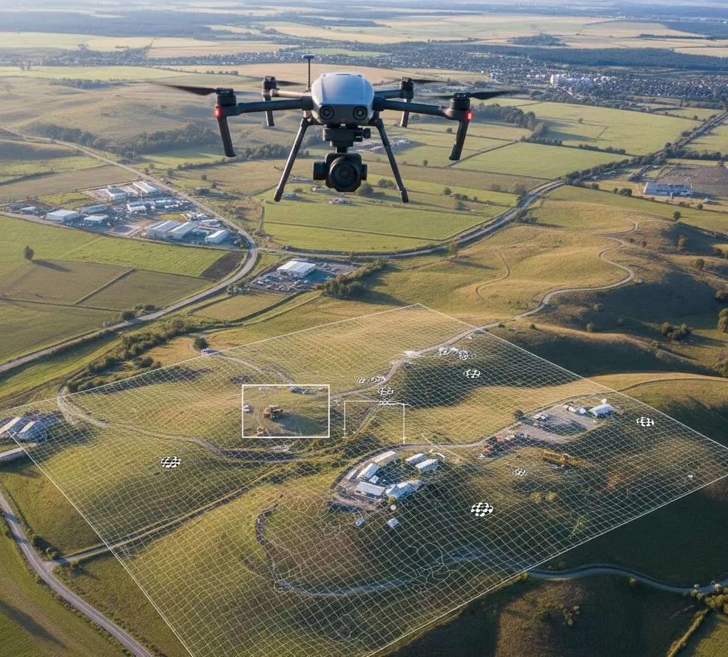
Photogrammetry Mapping Production
High-Resolution Orthophoto Production
Photogrammetric Base Map Production
Mine Area Mapping in MAPEG Standards
Point Cloud Generation
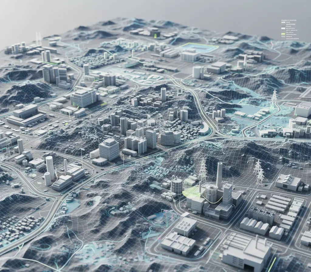
3D City Model Production
3D Mapping Design Projects & 3D Modeling
We provide solutions that support analysis, planning, and presentation processes by modeling land, structures, and facilities in three dimensions using LiDAR technology.
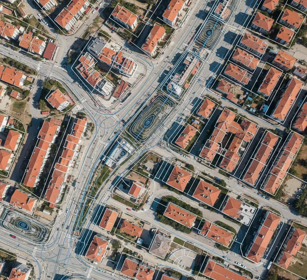
Digital Base Map Production
We produce up-to-date, reliable, and regulation-compliant digital base maps for zoning, infrastructure, and engineering projects.
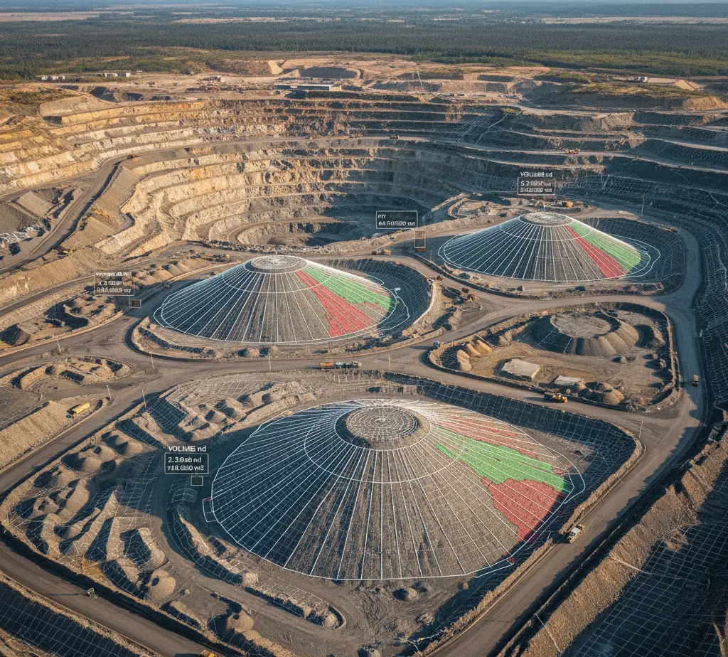
Mining and Stockpile Area Mapping Standards
We perform volume calculations, area analyses, and standard-compliant mapping studies for mining and stockpile areas.
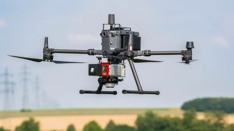
Manned and Unmanned Systems Payload Integration
We provide field-ready solutions through the integration of sensors, cameras, and measurement systems (LiDAR, GNSS, Gimbal, INS, IMU) into manned and unmanned platforms.